
The vast majority of Gold Coasters support the Oceanway. They know the wonderful benefits that the beachfront path brings. They want it to be continuous. Several missing links remain. The stretch along Mermaid Beach is the most hotly contested. Friends of the Oceanway believe this presents the greatest opportunity to improve public safety and create equitable access. It therefore deserves the highest priority for construction.
OCEANWAY OPPONENTS

Beachfront owners' privacy, amenity can be addressed with judicious landscape and lighting and design from within their own properties, as well as the public Oceanway corridor
First, we feel the need to address negativity about the Oceanway.
Opponents to the beachfront path are small in number but fierce in their stances. They want the Mermaid Oceanway to run along Hedges and Albatross Avenues.
Some owners of the 170 or so beachfront properties have mounted legal challenges to prevent construction of the path on public land in front of their homes. Understandably, they are concerned to protect their privacy and amenity.
Others concur with this alignment for environmental reasons. They lament that our coastline is not pristine and that the houses should never have been built so close to the beach. They think further seaward construction of any kind is unacceptable.
Negativity to the beachfront Oceanway in social media comments online relate mainly to three issues: dune protection, nesting turtles, and the cost of the project.
DUNE PROTECTION
Everyone agrees that dune protection is important. If we could turn back time to 1940, just before housing construction began in Mermaid Beach, it would be responsible to designate Hedges and Albatross as esplanades and cancel the seaward allotments which became today’s beachfront properties. However, unless the sea reclaims those, that’s not going to happen, so it behooves us to make the most of the existing situation.
Opponents of the beachfront path are concerned that an Oceanway path will exacerbate dune erosion but construction of a path along Mermaid Beach will be will be very much like the Surfers South to Broadbeach and Tugun to Bilinga sections of Oceanway which were completed in recent years. The profile of these paths is a 100-120mm ribbon of floating concrete. Even if cyclonic waves reach and crash over them, they are designed to disintegrate into small rocks that won’t worsen erosion.
Most of the Oceanway built to-date has been setback behind the A-line. The A-line is notional. Its significance is often conflated. It has no protective power itself. It simply reflects the extent of erosion experienced along the Gold Coast following cyclones in the 1960s and 70s. It serves as the common alignment of buried foreshore rock walls to protect houses and public infrastructure from damage by beach erosion.
When private beachfront properties are redeveloped, building works must be setback behind the A-line and owners must provide certification that a rock wall has been built or fortified to council specifications.
For public works on public land, the setback is not mandatory. If there are some points along the Mermaid Oceanway where there is insufficient width between a private property boundary and the A-line, and the dunes are healthy, it should be considered appropriate to cross the A-line.
In such instances, the public infrastructure extending seaward and is regarded as ‘sacrificial’. The description seems dramatic but it simply means that something may be more prone, and invokes obligation to calculate risk against benefit and the cost of potentially needing to repair or replace the path, or a section of it.
Aside from the Oceanway path, there is also a lot more that council and community groups and individuals could do to protect and enhance dunes along the entire coast.
The Management of Coastal Dune Areas planning policy gives guidance for dune planting and maintenance to promote diverse ecologies that support dune stabilisation. And while these are establishing better fencing and event management could encourage people to keep to designated paths and tracks to avoid trampling of dunes..
NESTING TURTLES
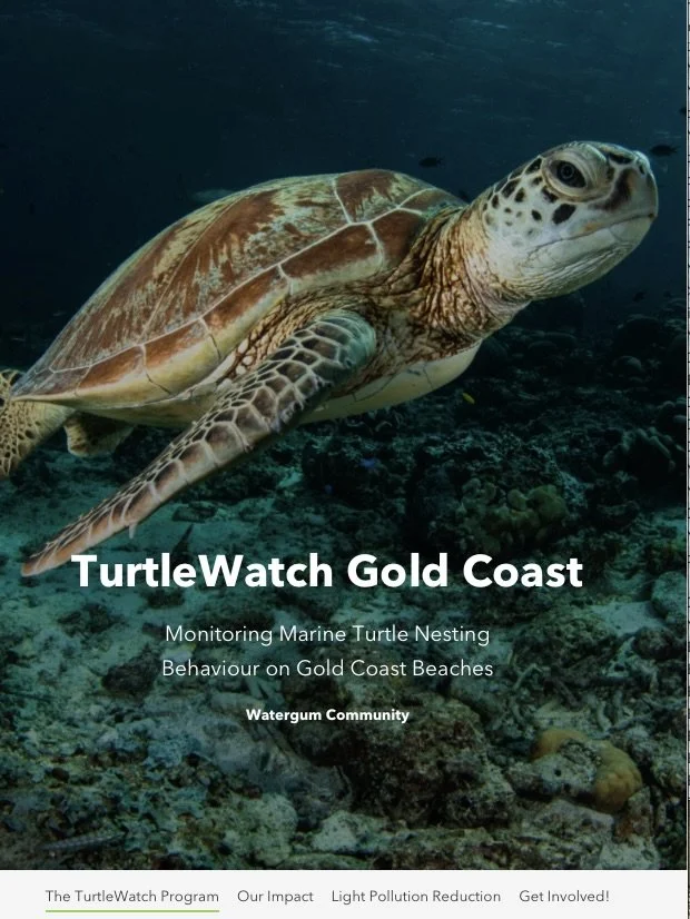
The ecological sensitivity of the Mermaid Beach stretch as habitat for nesting turtles and other wildlife has been claimed as a reason to prevent the Oceanway. With warming seas, over the past decade, turtles have been nesting further south.
There's a dedicated Turtlewatch program with 2000 volunteers who monitor turtle nesting on Gold Coast beaches. Last year there was one confirmed nest at Palm Beach and eight turtle sightings. To-date, none have been recorded at Mermaid Beach or Nobby Beaches. That's not to say they shouldn't be encouraged, but then that too, brings management considerations.
General consensus has been that it's safest and most appealing for turtles to come ashore and nest near nature reserves (The Spit, Tallebudgera and Currumbin estuary) which are buffered better from urban lighting, noise, and domestic animals and vermin that might damage eggs.
As previously mentioned there are ways (and indeed existing council policies and design guidelines) for lighting and planting which should be implemented along the Oceanway to promote the re-establishment of vegetation that is conducive to inhabitation by wildlife as well as dunal stabilisation. Currently, the public land in front of many houses has been turfed. Domestic grass does nothing to promote sand accretion or plant diversity. And at night, lighting from many houses projects and spills onto the dunes. This is the greatest deterrent to nesting turtles.
PROJECT COST
Contrary to persistent negativity about the standard Oceanway path being concrete and sacrificial, it’s actually cost-effective, quick to construct, and better for beach protection than a raised boardwalk. People are inclined to think that a piered boardwalk hovering above the dunes is more environmentally sensitive. However, piers need deep and large concrete footings and if these are exposed and fall into the ocean during a cyclone, they can pound the dunes like a wrecking ball. Whereas the conventional 100-125mm ribbon of concrete, designed with cracks to disintegrate under wave attack, will not exacerbate erosion. While we don’t have access to the council’s detailed planning and cost estimations, we asked Ai for a rough evaluation of concrete path vs piered boardwalk for 2.9km (not including lighting, landscaping, seats, bins etc)
3.5m sacrificial concrete path at grade $1.5 million (Life cycle 10-20 years unless a big erosion event. When it goes you re-excavate sand, re-form and repair. No piling waste left in dune)
4.5m raised boardwalk, marine grade piers locked 20m to bedrock $52 million
Therefore, the concrete path could be washed away and rebuilt 30+ times before reaching the capital cost of a single cyclone-proof boardwalk.
And while $1.5 million (or even double that to include extensive landscaping and specialist lighting) might seem a lot of money to people not experienced in capital project delivery, that’s actually just a drop in the ocean of council’s annual infrastructure and transport budget which is $543 million (2026/27). A cost benefit analysis would be compelling. The Return of Investment will be huge.
Click here to view the Ai BREAKDOWN OF COST ESTIMATES
PLANNING HISTORY
The early surveyor’s 1890s plan for the Mermaid Beach Estate had not anticipated beachfront properties. There was to be an esplanade, seaward of these called Los Angeles Esplanade, similar to Broadbeach, Miami, Burleigh and Coolangatta.
By the late 1940s and 50s when residential lots began to sell and people started building houses, beach erosion inhibited construction of the esplanade, and by default Hedges Avenue became the main north-south road. It therefore stands to reason that when the first town planning scheme was drafted in the 1950s the city engineer applied the road widening reservations with a longterm view to making proper pedestrian pathways.
In 1996 Mayor Ray Stevens, on behalf of the Mermaid Residents Progress Association, pushed a council decision to amend the 1994 planning scheme to remove the historical 1.5m road widening reservation from both sides of Hedges Avenue. The same scenario occurred at Surfers Paradise (Garfield and Northcliff Terraces) and Palm Beach (Jefferson Lane).
Because of this, without the road widening reservations, Hedges’ road reserve will always be too narrow to achieve a safe, unobstructed pedestrian path without removing the power poles. Under-grounding the power lines would necessitate remaking of footpaths and driveway crossovers, resurfacing and new street lights.
Even so, the pedestrian hazard of resident, trade and delivery vehicles entering and exiting properties would still remain. For this reason alone, the case against designating Hedges and Albatross Avenues as the Mermaid Oceanway is compelling.